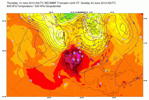
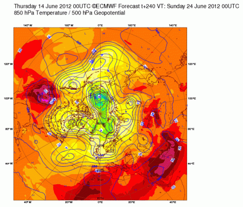
ECMWF forecast of 850 hPa temperature and 500 hPa geoppotential height made on June 14 2012 00UTC for June 24 2012 00UTC [click image above for sharper view]
The forecast made by the ECMWF for 10 days from now is a sobering image for those in the western USA that are already being plagued by fire and smoke. This heat is forecast to be as excessive as for Saudi Arabia! [ see below global image from ECMWF; click on image for sharper view]
In the context of global warming, this needs to be viewed as a regional circulation issue as the subtropical ridge becomes anchored over this part of North America.
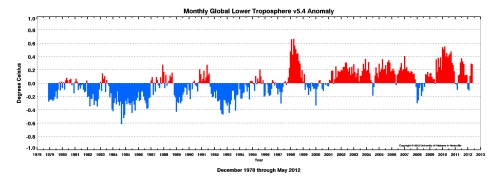
However, the global average lower tropospheric temperature anomalies are above the long term (1979-2012) average as seen in the AMSU data and in the latest UAH MSU and RSS MSU lower tropospheric analyses.

Thus, while regional circulations clearly dominate the reason for the upcoming heat wave, to the extent that a global average lower tropospheric temperature can be added to such events, there is a component of global warming involved. The subsequent evolution of the lower tropospheric temperatures (and in the upper ocean) in the coming months will be an effective metric to determine if this excessive heat is being accumulated long-term, or does the climate system manage to purge most of it to space.
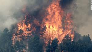
I regret that we will be seeing much more of the image below this summer.


